
Mud, glorious views.
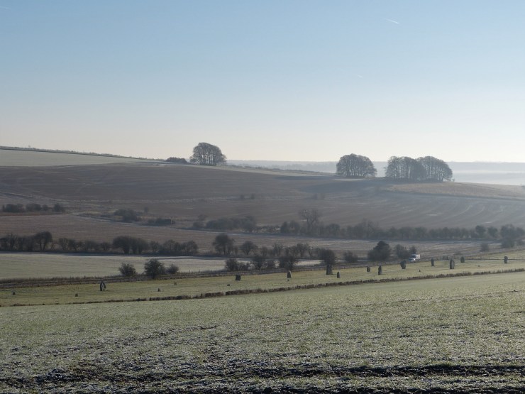
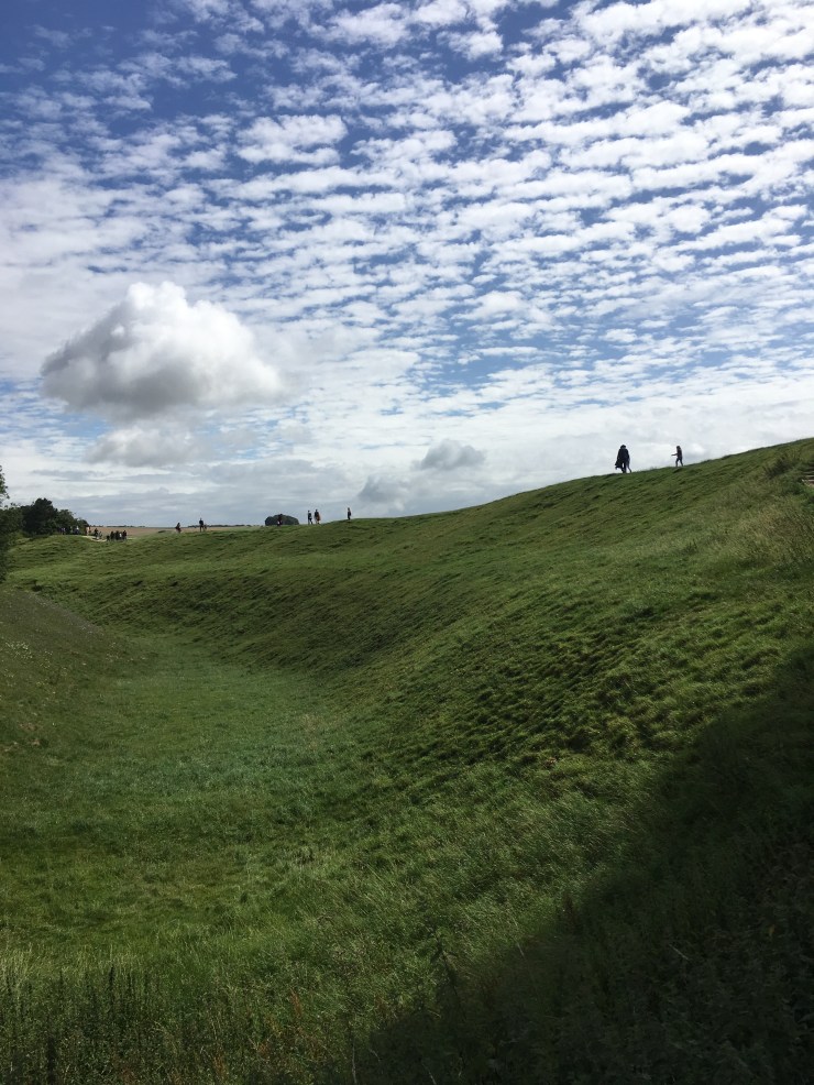
I was away for most of January so tales of tours are a bit few and far between. Sunday 29th however, a grey drizzly day, is one that deserves mention because it brought my first French guests: two families who were meeting at Stonehenge and then, after a couple of hours with me, heading for lunch at the incomparable Red Lion in East Chisenbury. Having been away I hadn’t realised just how much rain had fallen in the UK. At times like this I could do with information from the Stonehenge Cursus Racing Post about the ‘going’, and without doubt this day would have been described as ‘heavy’, and that an understatement. Trudging through mud trying to avoid rutted mires in rather unsuitable shoes, my guests nevertheless kept smiles on their faces as we progressed up the Apple Track from Durrington Walls towards the Stonehenge Cursus.
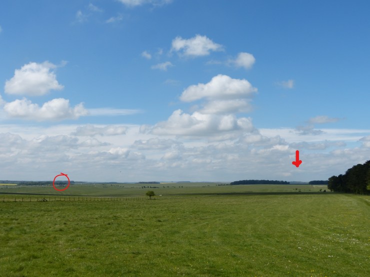
An antiquarian called William Stukeley gave many of Wiltshire’s monuments their names in the early 18th century and they have all stuck. Thinking this extraordinary elongated enclosed area was a Roman chariot racing course he named it The Cursus. In fact it is an early Neolithic monument (c.3,600BC), the purpose of which we have no idea but it demonstrates that the area was already important 600 years before anything happened at the place where Stonehenge now stands. From the eastern end of the monument where we stood you can look across the grassland to see tiny black figures, members of the crowds huddling around the sombre, grey stones of Stonehenge.

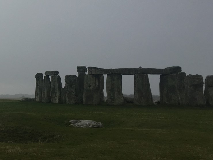
I hurried back to get the car leaving my guests to admire the view and we drove around to Stonehenge to meet their friends. The rest of our time together was very pleasant and they all seemed to enjoy themselves immensely strolling around the stones despite the fact that the drizzle had become steady, fine rain and, to be honest, we were soaked.
The next day was altogether different. The rain persisted in the morning so I decided to take my next guest first to Devizes Museum to see the UK’s foremost collection of Neolithic and Bronze Age artefacts including many from Stonehenge and Avebury. Despite the fact that it is closed on Mondays during the winter, a ring on the doorbell meant we were ushered in for a private look around while various home improvements were being carried out. It was great to have it to ourselves and I was far less self-conscious than usual having no other visitors to annoy with my chatter. After an early lunch we headed to the site of a late Neolithic monument called The Sanctuary, again named by our friend William Stukeley.
In the 1720s he witnessed the stones here being removed by indifferent local land owners for use in farm buildings. Disgusted as he was there was nothing he could do but draw and describe what was left, a dilapidated but nonetheless still recognisable double stone circle. The stones removed the land became part of the local farm and over the years the monument’s position, even existence, was forgotten.
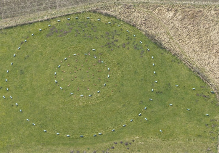
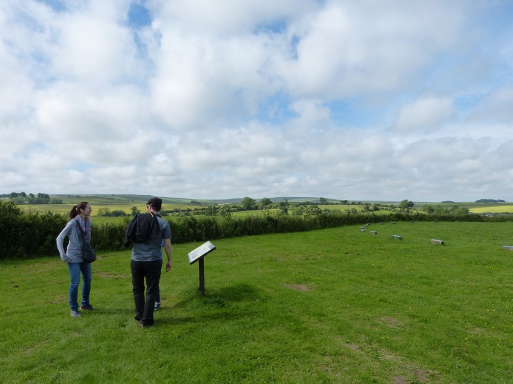
It was a lady called Maud Cunnington who determined to rediscover its place, which she did in 1930 before carrying out a rather hurried and, unfortunately for us, total excavation. Modern practice is to target small areas of an area of interest to leave plenty for future archaeologists to examine with even more sophisticated techniques. What she did discover however was that as well as the double stone circle there had also been concentric circles, six in all, of huge timber posts, the holes in which they had stood still clear in the chalk beneath the soil. She marked all the positions of the stone and post holes with concrete markers, blue for stone, red for post, which are still there today.
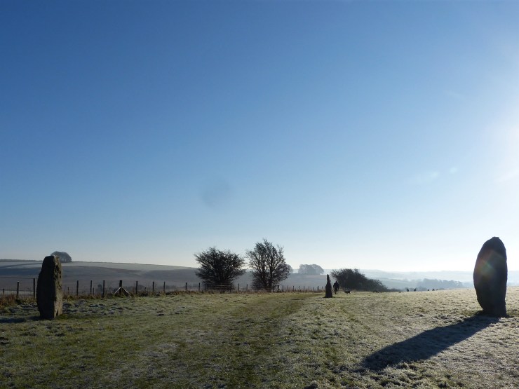
From here we walked down the route of West Kennet Avenue, a 1.5 mile processional route that was once lined by huge local sarsen stones linking The Sanctuary with Avebury. In this first part of the avenue four of the stones still exist sleeping like summer revellers in the hedgerow but most by far have gone, broken and reused many years ago. The walk is pleasant though and eventually, climbing out of the valley bottom, towards Avebury you pick the odd one up again, standing this time, until the famous resurrected line of West Kennet Avenue gives the most perfect approach to the south entrance of Avebury henge. In his fantastic new book Exploring Avebury, which often explores the role water played in this ceremonial landscape, Steve Marshall provides a convincing argument that this was not in fact one continuous avenue but two both leading to West Kennet Spring, one from The Sanctuary and the other from Avebury. It may still have been one route however with initiates perhaps leaving The Sanctuary then being ritually washed in the spring before continuing up the next avenue to Avebury.
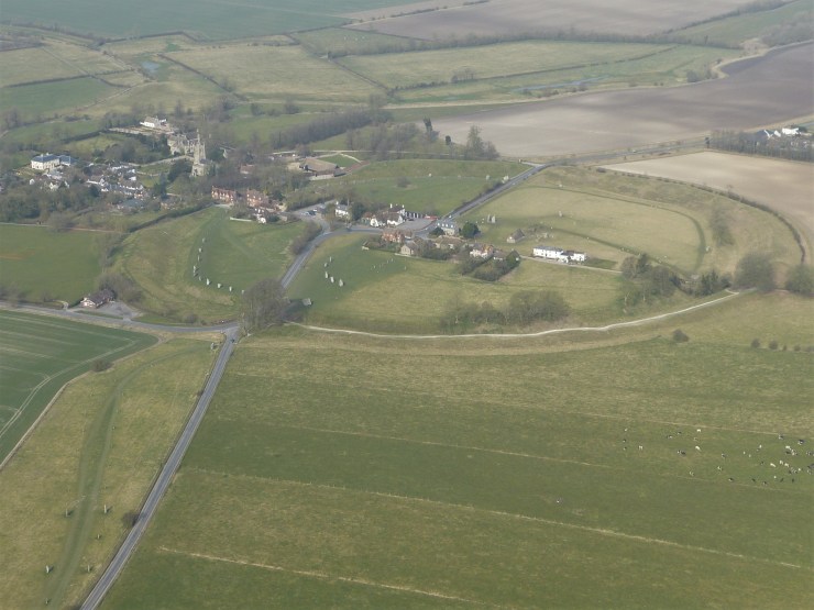
We didn’t spend much time at Avebury because we had a long walk ahead of us and my guest had been there many times before although as we wandered along the bank we chatted about theories as to its purpose and the different elements that make up this extraordinary monument: a massive circular henge 400 metres in diameter from the outer bank, a 9 metre deep inner ditch following the bank’s route, a circle of huge stones on the inner lip of the ditch, two inner circles of stones, some other smaller stones that may be the oldest part of the monument, and the Stukeley-named Obelisk and Cove which provided the centre pieces of the inner circles. Dated to the period 3,100 to 2,500 BC it must have been the site of extremely important ceremonies, the uninitiated perhaps watching the goings on inside the stone circles from on top of the bank as we were.

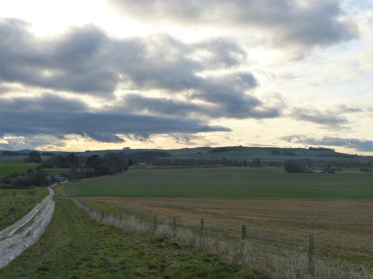
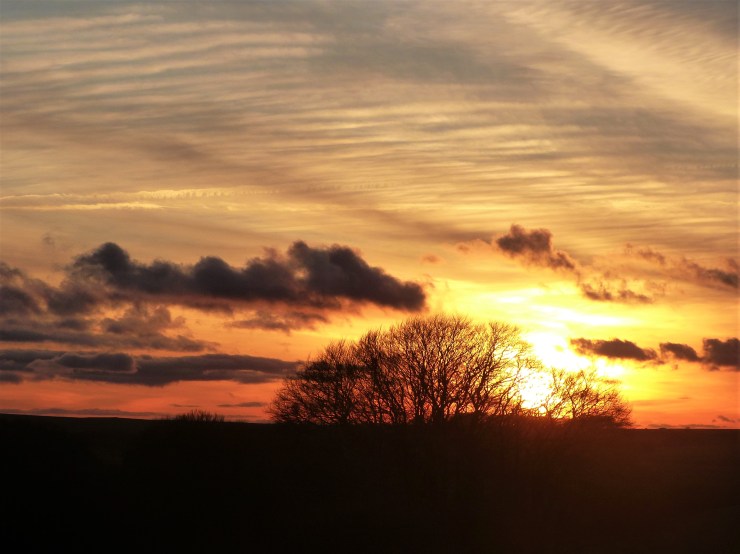
We exited through the east entrance, it has four at the cardinal points, heading towards the chalk downs in the distance and from here we didn’t see another person for the rest of the day. The Herepath or Green Street leads down initially and you soon pass a dairy farm on your right. As is to be expected the track here is thick with mud but today at least we were both kitted out in the proper footwear. You then begin to climb steadily towards the Ridgeway. It took us quite some time to complete this climb, not because we were struggling with the incline, but because the sky behind us was staggeringly beautiful and we were constantly turning around to admire it and take photographs.
Camera in hand I suddenly realised I could make out the faintest of super-moons low above the horizon ahead of us. It was a real wow moment and as you can see in the photograph a red kite did me the service of flying across its face just at the moment I clicked the shutter. If only it was better in focus!

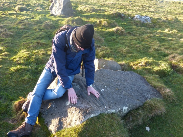
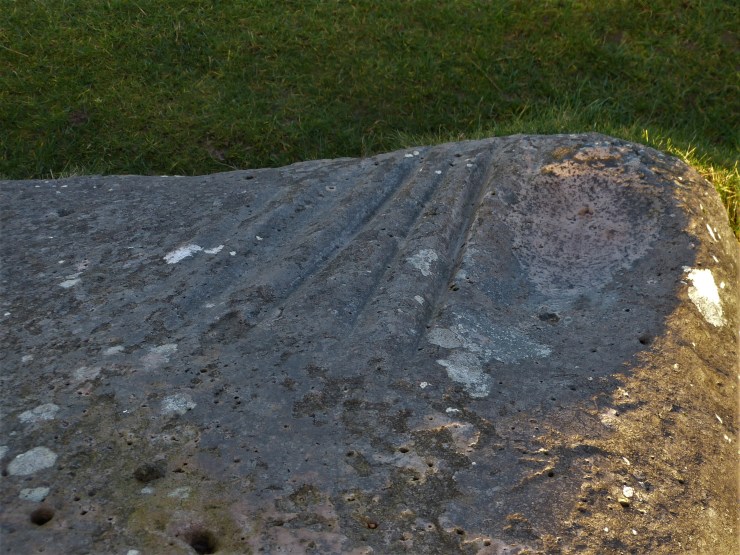
We continued on up, more and more in awe of the views and the developing weather. I had promised my guest a look at The Polissoir, a stone used for polishing stone axes during the Neolithic period. I always find it the most atmospheric of places and my guest had the exact same feeling.
Having tarried a while we headed back to the Ridgeway turning south to return to The Sanctuary, an amazing setting sun giving us the perfect end to our day.
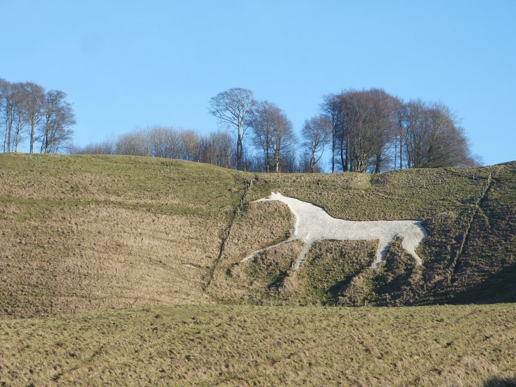
The next day was another off-the-beaten-track day this time with my ever-understanding wife. I had decided to attempt a new route up Cherhill down the chalk hill with its monument and famous white horse that greats you as you head east along the A4 from our home town of Calne. All the monuments in this area, the long barrows, Avebury bank, Silbury Hill were finally capped in chalk so these 18th century hill figures are great aids for imagining how the old monuments would have once looked.
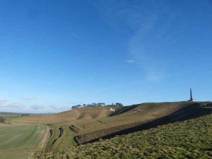
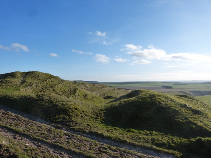
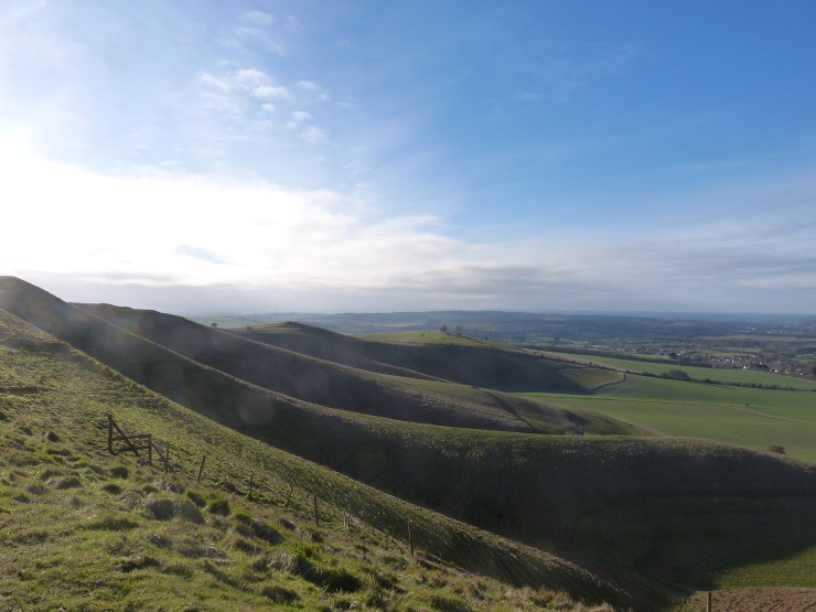
On top of the hill sits Oldbury Castle, the remains of a massive iron age hillfort, only the grassy ramparts now remaining, and the inspiration for Oldbury Tours’ name.
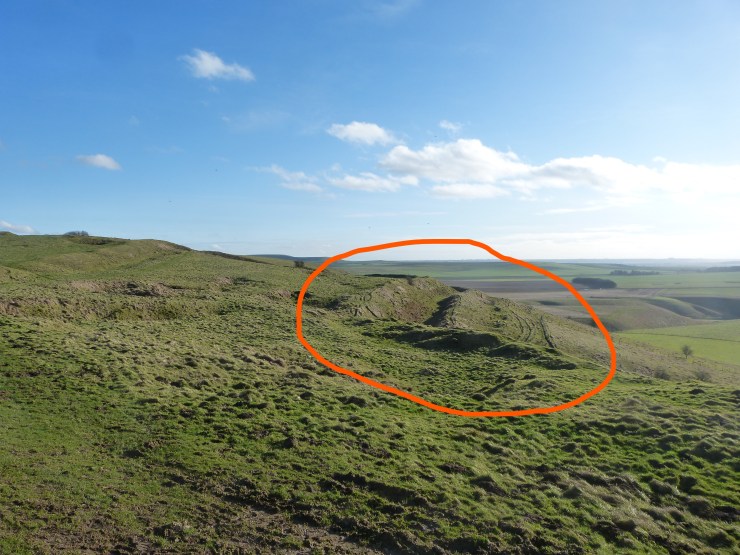
The route turned out to be less than ideal, ankle deep as we often were in mud and cow dung. My partner was stoical and we clambered over to the side of the valley and up looking back across the deep cuts of the hill slope to the white horse. Once on top the views are amazing and we completed the horseshoe circuit at a leisurely pace. It is hard to imagine actually living up there especially in foul weather but when the weather was good they must have loved the views as much as we always do.
Please visit oldburytours.co.uk for more information on the prehistory of Wiltshire or to book a tour.
